The implementation of 3D visualization in drone imagery is a key innovation for real estate developers, with numerous benefits both from the perspective of operational efficiency and marketing effectiveness. By using this tool, it is possible to significantly reduce the time it takes to complete projects, optimize costs and present high-quality visualizations to potential investors and customers, which will certainly contribute to the real estate developer's success in the market.
What are the benefits of using 3D visualization in a drone photo?
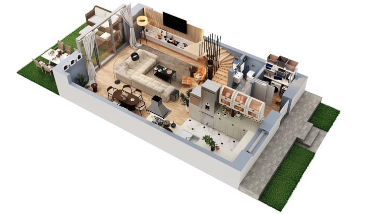
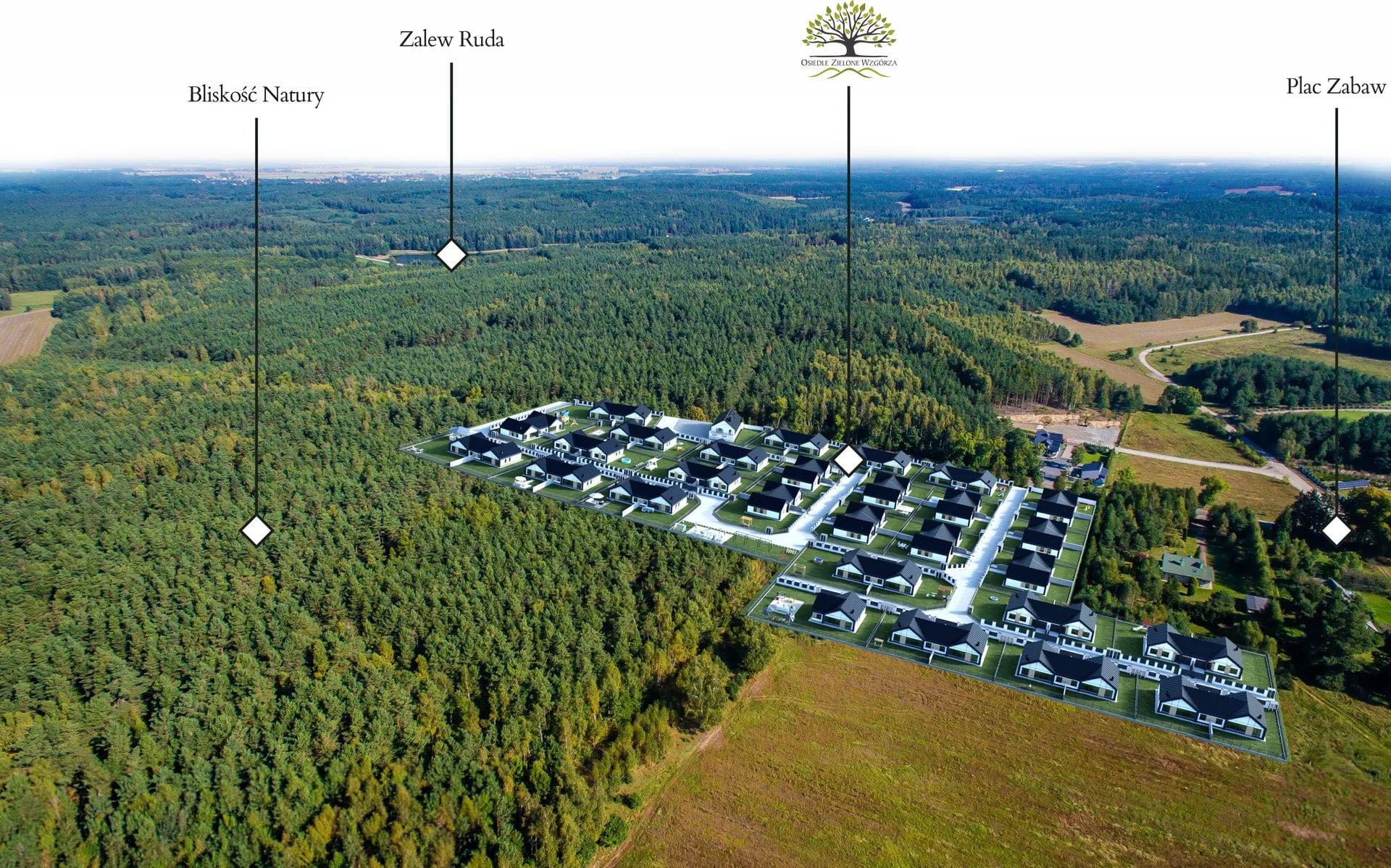
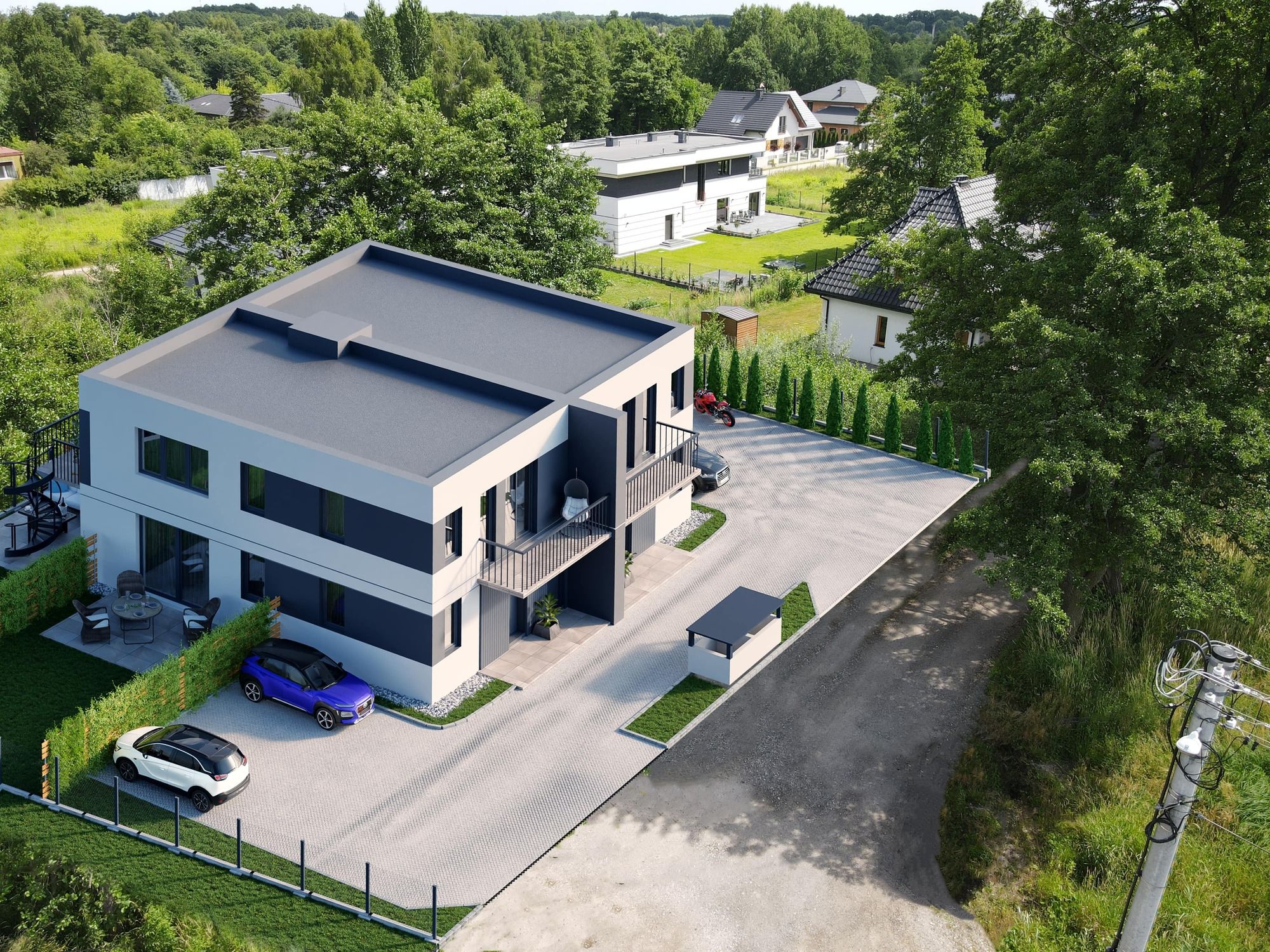
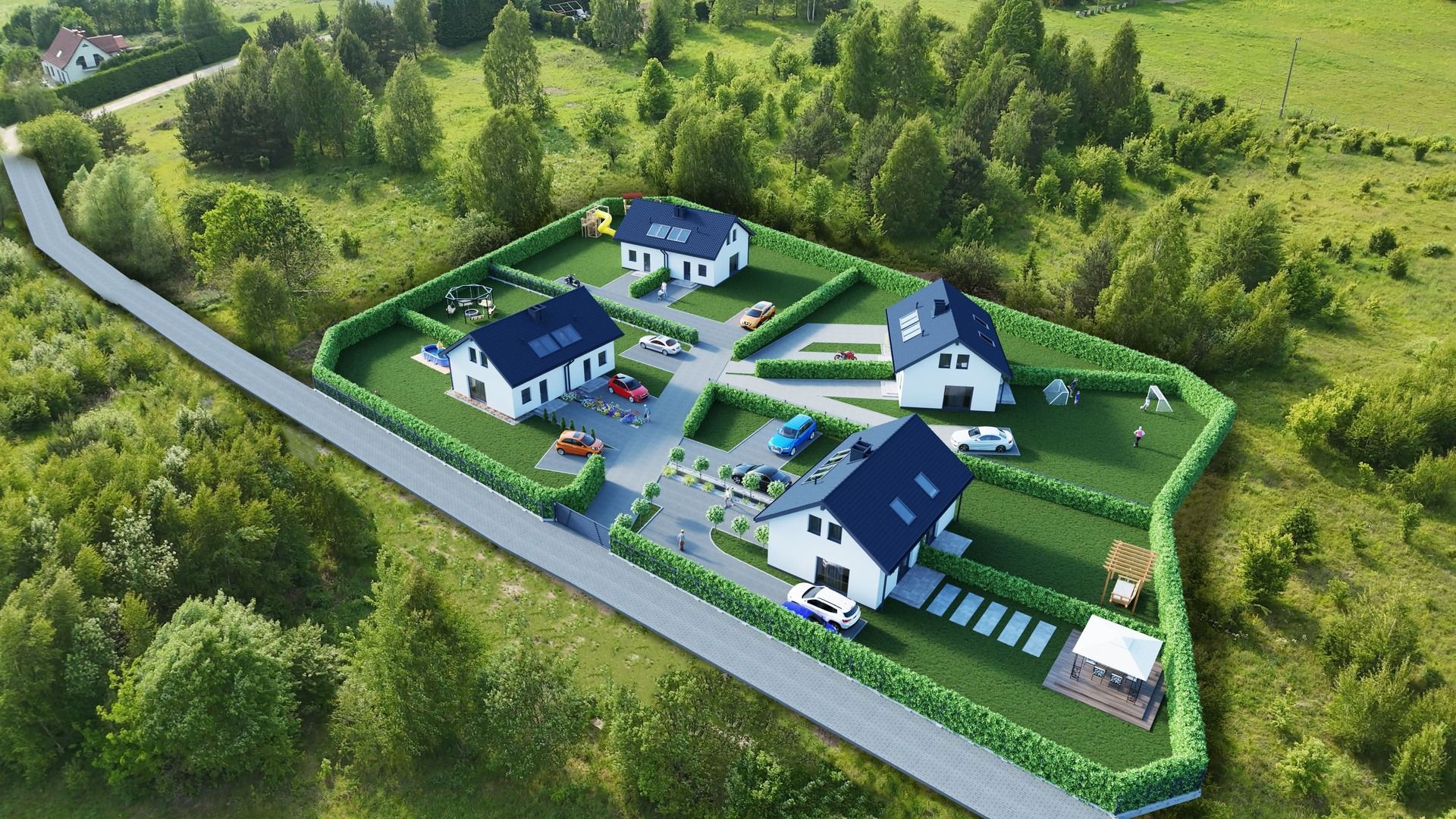
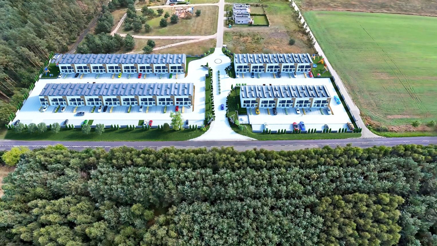
- Better presentation of surroundings: The use of 3D visualization in drone imagery allows real estate developers to present their developments in a more attractive way. The drone allows for a unique bird's-eye perspective that shows the entire project in the context of its surroundings.
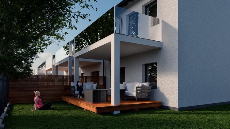
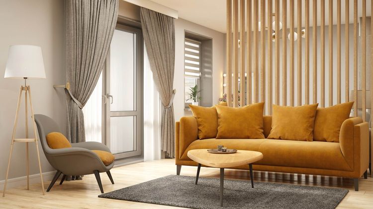
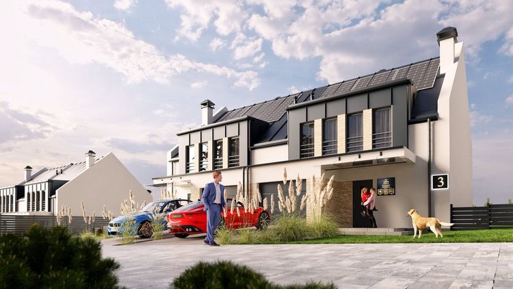
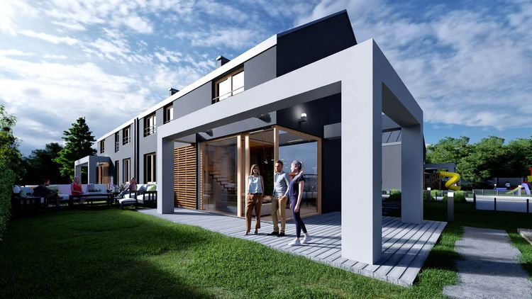
- Photorealistic visualizations: Thanks to 3D technology, 3D visualizations in drone shots can depict a project in a truly realistic way. Potential buyers and investors will be able to see what a project will look like once it is completed, which helps to better understand its potential.
- Reduced time and cost: Traditional methods of creating 3D visualizations require drawing up plans, models and renders, which can be time-consuming and costly. Drone photography and 3D visualizations allow for faster, realistic results without the need to create complex models of the entire environment.
- Marketing and promotion: 3D visualizations in drone shots are an extremely effective marketing tool for real estate developers. They can be used to create attractive promotional materials, such as flyers, advertising brochures, investment websites or advertising videos that will attract the attention of potential customers.
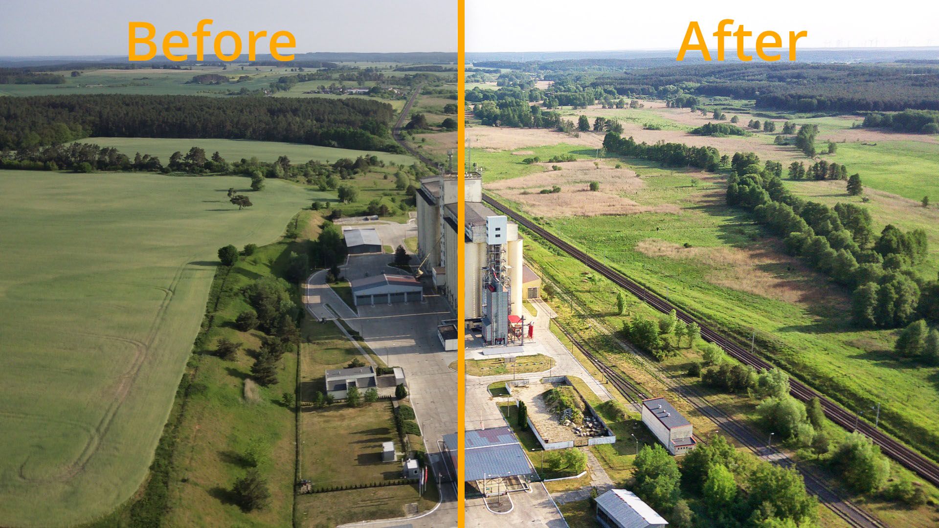
- Monitoring and documentation of work progress: At regular intervals, photos can be taken from a drone to accurately track the stages of the project. Such documentation can be used to build credibility and trust in the market, in front of potential customers.
- Increasing customer confidence: Using 3D visualization in drone shots shows that the real estate developer is innovative, cares about the quality of its investments and relies on modern technology to better present its investment. This, in turn, builds customer confidence and can attract more potential buyers.
See property investment visualization projects
See how similar solutions looked in real REND.PRO projects.
How much does it cost to take pictures from a drone?
The price of drone photography can vary depending on a number of factors, such as the location, the type of photo shoot, the duration and complexity of the task, and the experience of the drone operator.
In general, prices for drone photography services range from a few hundred to a few thousand USD, depending on the scope of work and project specifications. For example, simple bird's-eye shots without additional editing can be cheaper than more advanced projects, such as photogrammetry, technical inspections, or advertising videos.
It's best to contact local companies specializing in drone services and ask for a quote based on your specific project.
How many drone shots are worth taking?
The amount of drone footage worth taking depends on the purpose and scope of the project.
Here are some factors to consider:
- Purpose: Determine what the drone photos taken will be used for. Will you use the photos taken to showcase the investment with 3D visualization in a drone photo, or just to showcase the progress of construction?
- Scope of the project: Specify the area you want to capture in the drone photos. Should it be just one location or a larger area that presents the advantages of the location and requires photos from different perspectives?
- Season and weather conditions: If you want to capture the changing environment of the investment and its appearance in different seasons, you may want to consider taking a series of photos from a drone in different seasons.
- Budget: It is also important to consider your available financial resources. You need to decide how much you are willing to spend on taking photos from a drone.
There is no specific recommendation for the number of photos from a drone, as it depends on your individual needs and expectations. It is worth consulting with the drone operator and the company that is marketing your property development.
What kind of weather is best for creating images from a drone?
The best weather for creating photos from a drone is usually sunny and cloudless. Here are some factors that can affect the quality of your drone photos:
- Sunny day: Bright and sunny skies provide favorable illumination of the subject/plot, resulting in clear and contrasty images.
- Cloudless sky: The absence of clouds makes the background uniform and does not distract the viewer. You can then focus on capturing the main subject of the photograph.
- Low humidity: Humid air can affect the quality of an image through haze or loss of sharpness. In dry conditions, the air is clear, which promotes better visibility and sharpness in photos.
- Low winds: Strong winds can make it difficult to stabilize the drone and lead to shaking in photos and videos. Therefore, it is advisable to choose days with low wind speeds.
- Morning or evening hours: The light in the early morning or during the golden hour just before sunset is softer and warmer, giving photos a beautiful effect. Avoid the hottest hours of the day, when the sun is at its zenith (usually 12:00 pm), as hard light can lead to shadowing and loss of detail.
What does a real estate developer need to keep in mind if he is creating the drone images himself?
- Legal compliance: The real estate developer should be aware of local laws and regulations regarding drone use. He must obtain the necessary permits and licenses, if required, and comply with drone flight restrictions.
- Safety: It is important for a real estate developer to follow the rules for safe drone use. He should choose a suitable launch and landing site and avoid areas where it can pose a danger to people or property. In addition, the real estate developer should ensure the safety of the drone itself and regularly check the equipment's technical condition.
- Drone equipment: the real estate developer should ensure that the drone is properly equipped to take pictures. Depending on the needs, this may include a high-resolution camera, image stabilization systems, additional sensors, etc. It is also important that the drone is compatible with the appropriate photo editing software.
- Planning and composition: Before flying, the real estate developer should carefully plan the route and the frames he wants to capture. He or she should be aware of the purpose of the photos and choose the angle, perspective and composition accordingly to get the best results. Flight planning may also include consideration of weather conditions and optimal lighting.
- Photo processing: Once the photos have been taken, the real estate developer should take care to process them to improve quality and presentation. This may include adjusting contrast, color saturation, retouching minor defects, etc. There are many professional photo editing programs that can help with this process.
In what format should a real estate developer save drone images?
The best format for recording drone images is RAW or native format.
Drones often have their own recording formats that are optimized for specific hardware and software. For example, some popular native formats for drones are DNG (Digital Negative) for photos and DLOG or D-Cinelike for video recordings.
When saving in RAW or another native format, however, the real estate developer should keep in mind that these files are larger than images in other formats, such as JPEG. This requires more memory capacity and potentially longer processing times. It is also important to have the right software that handles these files and allows editing.
Need 3D visualization in a drone photo?
Check out our offer here: Photorealistic 3D visualizations of a property development project
FAQ - Frequently Asked Questions
1. What is a 3D visualization on a drone photo?
It is a combination of realistic 3D visualization with drone photography that allows an attractive presentation of the investment and its surroundings from a bird’s-eye view.